Global Sailing Travel Business Map – Market Analysis
RJ0600072_31
- Last Update 07/09/2025
- File Size 0.7MB
- # of Slides 2
- File Format PPTX
- Slide Ratio 16:9
- Color
Keywords
About the Product
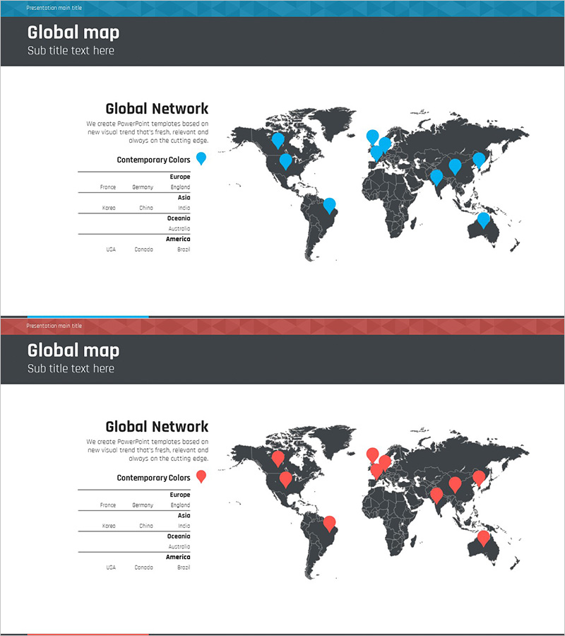
A professional PowerPoint slide designed for global market analysis and international business strategy presentations. Features a dark gray world map with blue or red markers to highlight branch offices, partner locations, and market positions across two customizable versions. The left side includes dedicated text areas organized by continent and country for documenting regional business status, market size, and expansion strategies. Delivered in 16:9 widescreen PPTX format for immediate editing. Ideal for investor pitches, executive briefings, and global expansion planning presentations that require credible geographic visualization.
Usage Points
-
Main Usage
Visualize global market analysis and international business presence. Display branch offices, partner locations, and market positions on a world map using color-coded markers to communicate international expansion strategy, market entry plans, and global network status at a glance.
-
How to Use
Use in investor relations presentations, executive reports, and global strategy briefings. Fill the left-side text areas with continent and country-specific business data, market metrics, and expansion timelines. Position map markers to indicate geographic presence and create a compelling narrative around international business objectives.
-
Recommended For
Recommended for executives, strategy teams, and international business managers at companies pursuing global expansion. Ideal for export-import businesses, multinational corporations, and global service providers presenting market analysis, competitive positioning, and geographic growth plans to stakeholders.
-
Slide Structure
Two-slide set. Slide 1: Blue marker version with world map, left-side text input areas, continent-country list, and legend. Slide 2: Red marker version with identical layout and structure. Each slide includes title area, subtitle, map visualization zone, color legend, and organized text regions for regional data entry.
Related Products
-

Spring Pastel Wide PowerPoint Template Map
#Company Introduction #Market and Competitor Analysis #Other
-

Global User Analysis Graph
#Company Introduction #Market and Competitor Analysis #Graph
-

Two-country Comparison Chart - Market Analysis and Global Business
#Company Introduction #Product/Service Introduction #Market and Competitor Analysis
-

Global Area Analysis Bar Graph – Visualization of Market and Competition
#Company Introduction #Market and Competitor Analysis #Graph
