Country-by-country Status Analysis Map Template
RJ0300002_21
- Last Update 04/19/2025
- File Size 14.3MB
- # of Slides 2
- File Format PPTX
- Slide Ratio 16:9
- Color
Keywords
- #Content-Based Slides
- #Design-Based Slides
- #Company Introduction
- #Graph
- #Other
- #Global Network
- #Customers and Partners
- #Circles
- #Doughnut Chart
- #Map
- #16:9
- #world map PowerPoint slide
- #global status analysis presentation
- #regional data visualization
- #international market analysis slide
- #map infographic template
About the Product
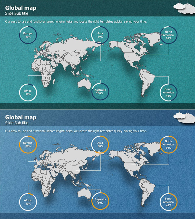
A world map-based global status analysis PowerPoint slide featuring 2-slide layouts with teal and navy blue backgrounds and beige-toned geographical maps. Six major regions (Europe, Asia, North America, Africa, Australia, South America) are marked with circular charts and percentage data connected by leader lines, enabling at-a-glance regional comparison and global distribution insights. Designed for immediate use in presentations, reports, and strategic plans to visualize international market analysis, regional performance, and global network status. Provided in 16:9 widescreen PPTX format optimized for modern presentation environments.
Usage Points
-
Main Usage
Visualizes global distribution across six major regions using circular charts overlaid on a world map, enabling intuitive comparison of international market data, regional revenue, global network status, and overseas business performance. Effectively emphasizes regional disparities and global positioning in executive reports, investor presentations, and strategic planning documents.
-
How to Use
Enter title and subtitle at the top of the slide, then replace percentage values in each regional circular chart with actual data. Color scheme can remain in default teal and navy tones or be customized to match corporate branding. Region names and numerical values are fully editable via text formatting. Two-slide layout supports time-series analysis, comparative studies, and multi-metric representation.
-
Recommended For
Recommended for executives, marketing teams, and strategic planners in international business, global marketing, and overseas operations. Ideal for investor relations presentations, business performance reports, market analysis plans, international expansion strategy presentations, and multinational company introductions requiring regional status and global network visualization.
-
Slide Structure
2-slide composition with world map (beige tone) centered on each slide. Six regions (Europe, Asia, North America, Africa, Australia, South America) feature circular charts (approximately 80px diameter) with percentage text connected by leader lines. First slide uses teal background; second slide uses navy blue background for color variation. Each regional circular chart is independently editable.
Related Products
-

Global Network World Map Slide – Explore with Blue and Green
#Company Introduction #Graph #Other
-

Overseas Market Customers Slide - Customer Analysis
#Company Introduction #Text Box #Other
-

Square Frame Template Global Map – Overview of Global Network
#Company Introduction #Other #Global Network
-

World Map and Learning Content Icon – Visualization of Global Network
#Company Introduction #Other #Global Network
