Show Global Routes - Global Network Diagram
RJ0600058_19
- Last Update 07/06/2025
- File Size 2.1MB
- # of Slides 2
- File Format PPTX
- Slide Ratio 16:9
- Color
Keywords
- #Content-Based Slides
- #Design-Based Slides
- #Company Introduction
- #Business Introduction
- #Diagram
- #Other
- #Global Network
- #Infrastructure
- #Cluster
- #Chain Diagram
- #16:9
- #global network diagram
- #world map PowerPoint slide
- #international connection diagram
- #business infrastructure PPT
- #global route map slide template
About the Product
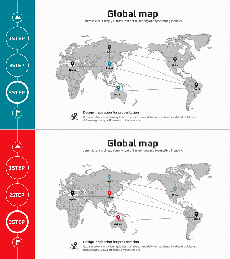
A 2-slide PowerPoint presentation visualizing international network connectivity with a world map background. Five major cities (Algeria, China, Australia, Brazil, USA) are represented as nodes with connecting lines showing global infrastructure flow. The left sidebar features circular step indicators (1STEP, 2STEP, 3STEP) with flag icons to clearly communicate process progression. Two color versions are included—teal and red—allowing you to match your presentation theme. Provided in 16:9 widescreen PPTX format for immediate editing and customization.
Usage Points
-
Main Usage
Ideal for explaining international business infrastructure, global supply chains, and multinational network structures. The world map with key hub locations and connecting lines clearly conveys cross-border interactions, making it perfect for presentations on international partnerships, branch networks, and global expansion strategies.
-
How to Use
Slide 1 features a teal background; Slide 2 uses red. Double-click city names and connection lines to edit text and colors. Modify sidebar step labels to match your process stages. Drag node positions on the map to align with actual locations or insert additional cities as needed.
-
Recommended For
Suitable for international business strategy, global expansion plans, supply chain management, regional network introductions, and international collaboration projects. Ideal for executives, business development teams, international marketing managers, and infrastructure planners presenting global hubs and connectivity structures.
-
Slide Structure
2-slide layout. Each slide contains a world map (gray tone), 5 city nodes (pin icons), linear connection lines (with arrows), left sidebar (circular step indicators 1–3 with flag icons), title and description text areas. 16:9 widescreen PPTX format.
Related Products
-

Global Infrastructure Slide – Visualizing Global Networks
#Company Introduction #Business Introduction #Diagram
-

Building Infrastructure Slide – Efficient Connection and Global Network
#Company Introduction #Business Introduction #Diagram
-

World Maps and Target Areas – Global Network Visualization
#Company Introduction #Business Introduction #Diagram
-

Global Partnership Mediated by Nature – Eco-Friendly Design
#Company Introduction #Business Introduction #Diagram
