Triangle Pattern Template Global Map – Connecting Global Networks
RJ0200016_19
- Last Update 04/02/2025
- File Size 6.4MB
- # of Slides 2
- File Format PPTX
- Slide Ratio 16:9
- Color
Keywords
About the Product
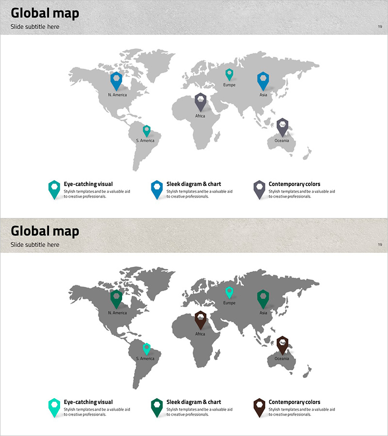
A world map PowerPoint slide designed to visualize global business networks and international presence. The slide features a gray-toned world map with color-coded pin markers positioned across six major regions: North America, South America, Europe, Africa, Asia, and Oceania. Three distinct pin styles in teal, blue, and gray tones allow you to categorize regions by office type, customer segment, or partnership tier. Each pin includes an editable text field below for adding region names, office locations, or descriptive labels. Ideal for company presentations, investor pitches, and global strategy briefings where demonstrating international reach and network scale is essential.
Usage Points
-
Main Usage
Communicate your company's global footprint, international customer base, and partnership network to investors, stakeholders, and team members through a clear, map-based visual representation of geographic distribution.
-
How to Use
Enter office names, customer names, or partner names in the text fields below each regional pin marker. Customize pin colors to distinguish between office types (headquarters, branch, customer, partner). Insert into company overview presentations, investor pitch decks, or global expansion strategy slides.
-
Recommended For
Multinational corporations and global enterprises presenting company overviews, international expansion strategies in investor relations presentations, business development meetings highlighting global partnerships, and executive briefings on overseas operations and market presence.
-
Slide Structure
Two-slide layout with the first slide using teal, blue, and gray pin styles to categorize regions, and the second slide featuring green, brown, and black tones for alternative classification schemes. Both slides contain six editable text fields positioned below each regional pin marker, allowing flexible customization of location names and descriptions.
Related Products
-

Global Maps and Textboxes – Introduction of Customers and Partners
#Company Introduction #Other #Global Network
-

Orange Yellow Map Location Indicator – Global Network Indicator
#Company Introduction #Diagram #Other
-

Overseas Market Customers Slide - Customer Analysis
#Company Introduction #Text Box #Other
-

Market Analysis by Country Slide – Global Business Strategy
#Company Introduction #Other #Global Network
