Global Map Highlighting Each Continent – Insights into Global Network
RJ0500006_15
- Last Update 06/08/2025
- File Size 1MB
- # of Slides 2
- File Format PPTX
- Slide Ratio 16:9
- Color
Keywords
About the Product
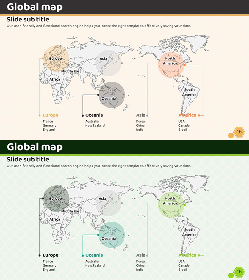
A global map PowerPoint slide that highlights five continents with distinct color coding in beige, gray, orange, and green tones. This design visually separates each region to effectively communicate global network reach, international business scope, and regional marketing strategies. Two design variations (beige tone and green tone) allow you to match your presentation's color scheme, while key country listings beneath each continent (France, Germany, England, Australia, New Zealand, Korea, China, India, USA, Canada, Brazil) provide concrete market information. Optimized for 16:9 widescreen format to fit modern presentation environments.
Usage Points
-
Main Usage
This slide communicates global business scope, international network presence, and regional marketing strategies at a glance. Color-coded continents provide clear regional distinction, while country listings beneath each region convey specific business territories and market focus areas.
-
How to Use
Use in company profile presentations for global network sections, business plans for market expansion strategies, and investor pitch decks for international business scope. Add region-specific revenue, customer, or partner data in the text input areas to strengthen data-driven presentations.
-
Recommended For
Ideal for multinational corporations presenting company overviews, international business managers delivering strategy presentations, and global enterprises pitching to investors. Particularly effective for executive reports and partner collaboration proposals that require visual organization of regional business status and expansion plans.
-
Slide Structure
The slide features a title area at the top, a world map diagram in the center with five continents color-highlighted, and text input areas at the bottom for each continent. Each continent is visually marked with distinct colors, and adjacent spaces allow easy addition of country names and regional information for customized data presentation.
Related Products
-

Global Network Infrastructure – Diverging Flow Diagram
#Company Introduction #Business Introduction #Diagram
-

Global Map and Descriptive Text – Global Network Analysis
#Company Introduction #Market and Competitor Analysis #Other
-

Check Pattern Template for Country Analysis – Global Market Insights
#Company Introduction #Market and Competitor Analysis #Graph
-

Global Network and Icon Sign – Connecting Customers and Partners
#Company Introduction #Other #Global Network
