Global Scientific Research Network Slide
RJ0400002_18
- Last Update 05/17/2025
- File Size 2.5MB
- # of Slides 2
- File Format PPTX
- Slide Ratio 16:9
- Color
Keywords
About the Product
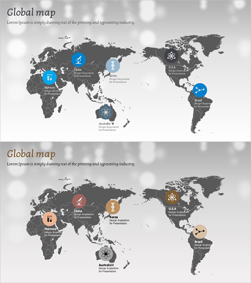
A 2-slide PowerPoint presentation set that visualizes global networks and international partnerships using world maps. Against a dark gray background, six regions—China, Morocco, South Korea, USA, Australia, and Brazil—are marked with blue and orange icons, enabling you to communicate your company's international presence at a glance. Each location includes dedicated text areas for adding region-specific information such as branch offices, partnerships, or research centers. This slide deck is ideal for business presentations, company introductions, and strategic expansion plans where international reach needs to be emphasized. Formatted in 16:9 widescreen ratio for modern projectors and online presentations, fully editable in PPTX format.
Usage Points
-
Main Usage
Visually represent international business locations, global partnerships, and multi-country operations. This slide effectively communicates your company's overseas presence, international research networks, and global supply chain structure to investors, partners, and stakeholders.
-
How to Use
Insert into the global network section of company profiles, international expansion strategy pages in business plans, and regional business updates during investor presentations. Add specific information such as branch office names, partner companies, or research institution names in the text areas next to each location icon.
-
Recommended For
Ideal for executives, business development teams, and marketing departments of multinational corporations presenting international operations. Particularly suited for companies with multi-country expansion, international research institutions, manufacturers with global supply chains, and international consulting firms.
-
Slide Structure
Two-slide layout featuring six blue icons on the first slide and six orange icons on the second, creating visual variety through color differentiation for different information layers. Each location has independent text input areas, allowing flexible addition of country-specific or region-specific details.
Related Products
-

Green Blue Global Network Slide
#Company Introduction #Other #Global Network
-

Visualizing Global Target Market – Effective Information Delivery
#Company Introduction #Market and Competitor Analysis #Other
-

Global Network and Icon Sign – Connecting Customers and Partners
#Company Introduction #Other #Global Network
-

Learning Global Map and Post-it Notes – Visualizing Global Network
#Company Introduction #Other #Global Network
